Create and display 3D scans with AR
vGIS is a leading augmented reality (AR) solution for visualizing 3D scans and performing utility-grade reality capture.
vGIS is a leading augmented reality (AR) solution for visualizing 3D scans and performing utility-grade reality capture.
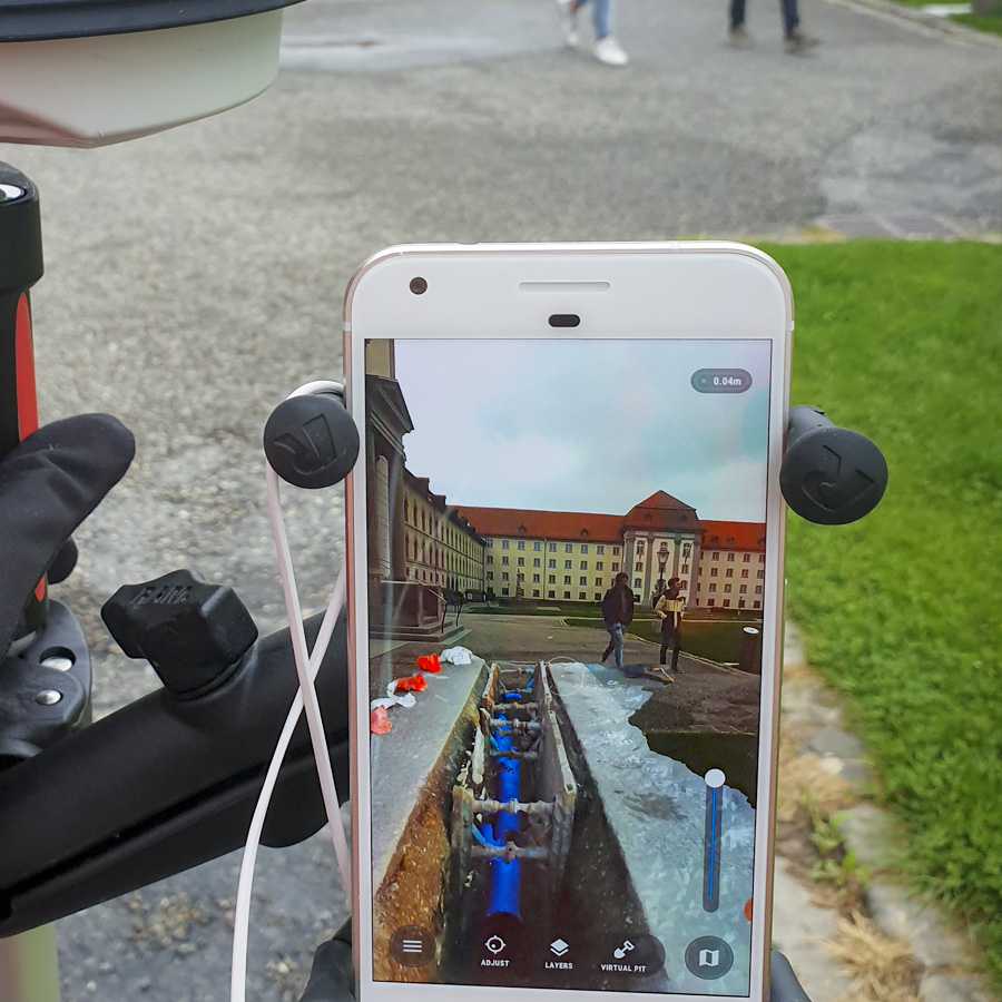
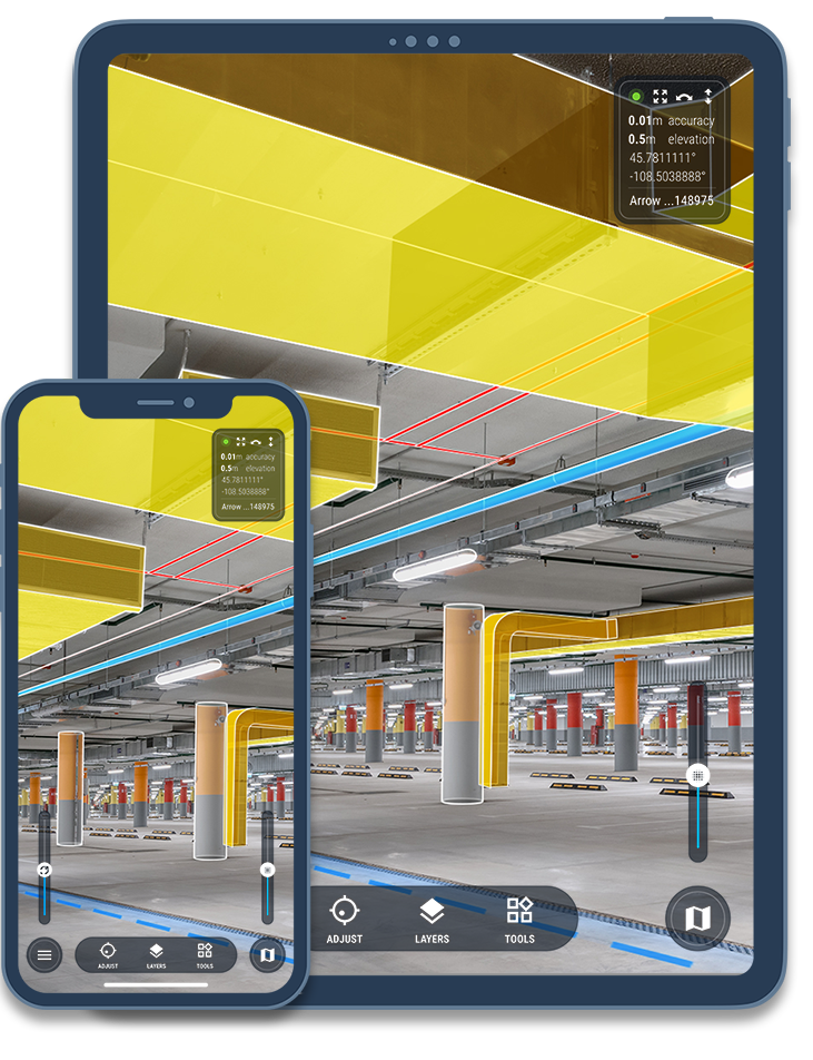
vGIS adds a new dimension to your 3D scans and point-cloud data by displaying it in augmented reality with centimeter-level accuracy.
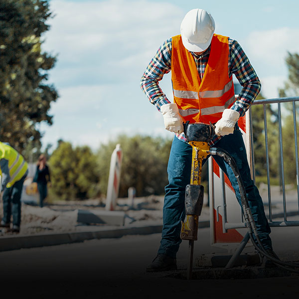
Review previously documented excavations or perform 3D scans using only your Android phone, iPhone, or tablet to make better decisions and avoid costly mistakes and delays.
With a few lines of code, vGIS integrates with your current reality-capture providers, like Autodesk, Bentley, Esri, and Leica, so that you can publish your 3D scans in vGIS from your existing archives automatically.
| Explore Use Cases |
Displaying 3D scans in augmented reality permits instant and comprehensive awareness of the information being reviewed and provides the details that experts need to assess complex information remotely.
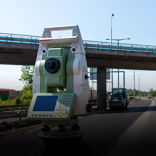
vGIS allows you to perform 3D scans either directly from vGIS or by using your existing provider, such as Leica Infinity or Pix4D.
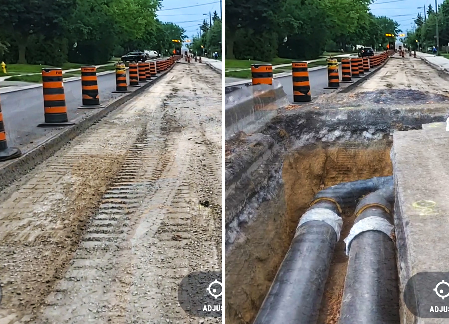
Being able to see various stages of work in progress or excavations exactly as they were long after the work has been completed gives you new opportunities to audit job quality, reduce excavation and maintenance costs, and react more quickly during emergencies.
A few of many reasons to use AR and 3D scanning:
faster understanding of surroundings
faster locates in complex situations
projected reduction per excavation job
required to complete a scan
Companies from many industries and the government—AEC, utilities, service providers, federal agencies—use vGIS to help their engineers, field supervisors, project managers, and field workers to gain clarity and direction in their work.
use vGIS on job sites to detect design errors, avoid design clashes, and facilitate collaboration among project team members.
use vGIS on job sites to detect design errors, avoid design clashes, and facilitate collaboration among project team members.
use vGIS on job sites to detect design errors, avoid design clashes, and facilitate collaboration among project team members.